Chapter 1 / 4
Water, language and settlement
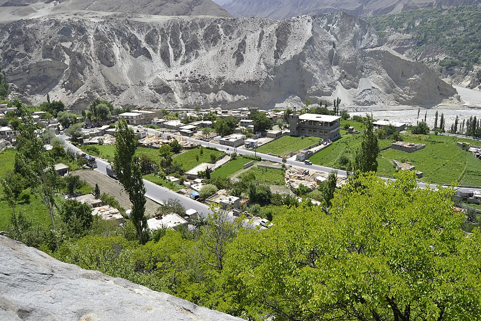
Hunza’s history begins with a practical achievement: making a home on steep, dry mountain slopes. Snow and glacier melt feed the river, but a river far below the fields does not irrigate them by itself. Channels carried water across difficult ground to terraces and orchards. Maintaining those channels demanded cooperation, labour and arrangements over who received water, and when. The green landscape in a photograph is therefore also a record of social organisation.
Hunza is not interchangeable with all of Gilgit-Baltistan. Nor is the entire valley one culturally uniform village. Central settlements, lower Hunza and upper Hunza or Gojal have different local histories. Across the river lies Nagar, historically a separate polity. A view across the valley can include places that belonged to different rulers, even though a modern visitor experiences them on the same journey.
Language preserves another layer of this history. Burushaski has no demonstrated genealogical relationship to another language family; that makes it a language isolate, not an unchanged relic outside history. Its vocabulary records borrowing and contact. Shina and Wakhi also belong to the valley’s linguistic landscape. These languages should not be treated as dialects of Urdu or as evidence for one simple story of descent.
Early dynastic traditions and tales of heroic ancestors remain culturally significant, but an attractive origin story is not the same as a dated document. Reading Hunza through water, settlements and language helps keep ordinary people in a narrative too often confined to kings and spectacular peaks.
Chapter 2 / 4
The mirs and the campaign of 1891
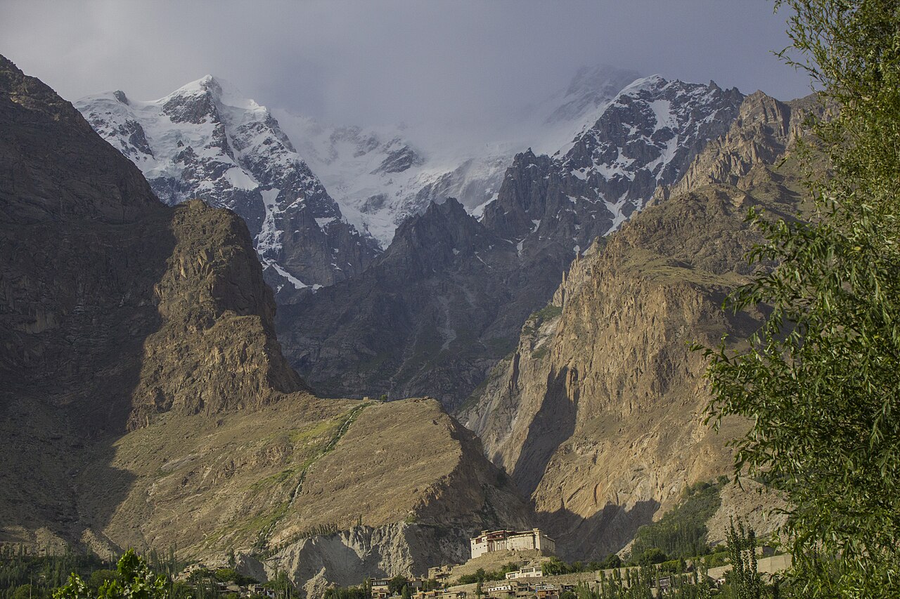
The rulers of Hunza, usually called mirs or thams, exercised authority through land, tribute and obligations of service. Forts were residences and instruments of government as well as defensive buildings. The relationship between a ruler and village households was not simply the benevolent family portrait sometimes offered to tourists. Political power had material consequences for access to resources and for the labour people owed.
In the nineteenth century, this small mountain state managed relationships with much larger powers. Connections toward Xinjiang coexisted with dealings to the south through Gilgit and Kashmir. British anxieties about Russian influence turned passes and frontier routes into matters of imperial strategy. This wider rivalry did not erase local choices, alliances or conflicts; it changed the pressures under which those choices were made.
The British-led Hunza–Nagar campaign of 1891 was a decisive rupture. Hunza and neighbouring Nagar were brought under British paramountcy within the frontier system associated with Kashmir and the Gilgit Agency. Mir Safdar Ali left Hunza; his brother Nazim Khan became ruler under the new arrangements. Local dynastic government continued, but it operated within a substantially altered balance of power.
Accounts written by imperial officers are useful evidence for routes, dates and military decisions. Their descriptions of the people they fought must be read critically. An officer’s claim that conquest brought order is a political argument, not a neutral description of everyone’s experience. For a visitor, Baltit is a good starting point for asking both how rulers lived and how the settlement below supported them.
Chapter 3 / 4
Schools, roads and the end of princely rule
In 1947 Hunza joined Pakistan, while the institution of the mir continued for another generation. The end of princely rule in 1974 was a separate event. Keeping those dates distinct matters: accession did not mean that every local institution changed immediately, and administrative reform did not remove the past from daily life.
Education was already reshaping possibilities. Research based on the memories of Hunza residents traces formal schooling to the early twentieth century and identifies the Diamond Jubilee school movement of the 1940s as an important stage. The expansion of learning involved local communities as well as educational institutions. It opened routes into professional employment and life beyond the valley, including for girls and women. These changes cannot be explained by scenery, diet or a romantic idea of a timeless mountain society.
The Karakoram Highway, completed in the late 1970s, altered the movement of people and goods. Journeys once organised around tracks and pack animals became increasingly connected to motor transport. Markets, construction, paid work and tourism expanded. A road created opportunities, but also new dependencies on supplies, cash income and infrastructure beyond the village.
This is why modern Hunza should not be described as a lost kingdom untouched until travellers discovered it. Residents have been participants in their own changing world: studying, moving, building businesses and debating development. Old institutions, new aspirations and the demands of a mountain environment have continued to interact rather than replacing one another neatly.
Chapter 4 / 4
Conservation, Attabad and the landscape today
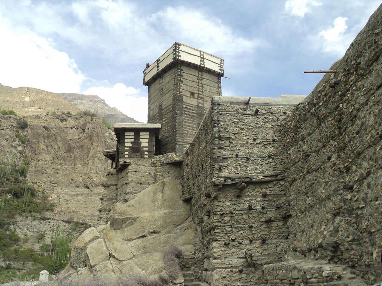
A historic building survives through choices made in the present. In Hunza, conservation has linked landmark forts to their surrounding settlements. Baltit’s restoration was completed in 1996; Altit’s followed in 2010. The work was not just an exercise in making picturesque walls. Water systems, housing, craftsmanship and the future of compact village centres were part of the wider question of how to keep heritage useful.
Ganish offers a different scale of history. Its small mosques and shared spaces shift attention from a ruler’s residence to neighbourhood life. Look at the relationship between buildings, paths and communal places, rather than searching only for a single oldest object. A settlement has an accumulated history: repairs, adaptations and continued use matter alongside original construction.
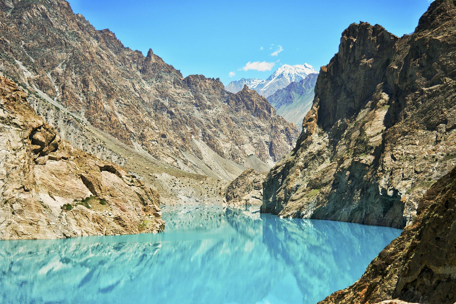
Attabad makes the connection between beauty and upheaval particularly clear. A landslide blocked the Hunza River in January 2010, creating a lake behind the debris. Rising water affected settlements and severed the highway. The blue water now familiar in travel photographs belongs to a recent disaster history, not a lake that has always occupied the valley. Its visual appeal should not eclipse the losses experienced by residents.
Hunza’s history therefore has several scales: the long labour of irrigation, the concentrated power of the mirs, the disruptions of conquest and reform, and changes within living memory. A thoughtful visit can hold all of these together. Read museum displays, use the photo credits and sources in this guide, and invite local guides to explain what an outside summary misses. No four-part overview can replace the different histories that families and settlements preserve.